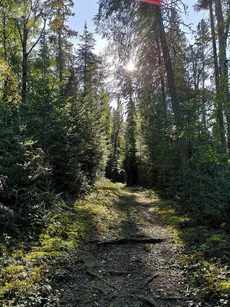
Paved, gravel, natural surface – trails take on a variety of forms. They can traverse great distances into the backcountry, travel through an urban park, or roam through local neighbourhoods. Historically, trails were used for the transport of goods and livestock between local villages and towns. Walking for leisure was a luxury, mostly reserved for those with garden paths or access to local forested trails. Recreational walking grew in popularity in North America at the end of the 19th century and gained traction post-war in the 20th century. The environmental movement of the 1960s and 1970s further inspired people to seek time outdoors in nature for relaxation and fitness.
Nowadays trails are tourist attractions and community refuges for outdoor recreation. I love to explore new and familiar trails.
A note about wildlife…
Wildlife can be encountered at any time while on trails. Human-wildlife coexistence is integral to safe and enjoyable recreation that also promotes wildlife conservation.
What is human-wildlife coexistence?
It is a sustainable state that encourages the co-adaption of humans and wildlife that live in shared landscapes. Regarding hiking, it seeks to ensure wildlife conservation while promoting safe human recreation. When planning for your hikes, please keep the local wildlife in mind and leave no trace.
Hiking In Saskatchewan
Saskatchewan boasts many beautiful landscapes that are unique to our province! Long associated with endless flat wheat fields, the province has so much more, including landscapes that people from elsewhere wouldn’t associate with Saskatchewan. It’s far from flat and featureless, and is home to species of plants and animals you can’t find elsewhere. Here are three hikes that may shift your perspective on what you think Saskatchewan has to offer.
1) Timbergulch Trail
Location: West Block of Grasslands National Park, Saskatchewan
Distance: 17km loop
Type: Day hike (5 or 6 hours)
Difficulty: Difficult
Website: Canada Parks Website
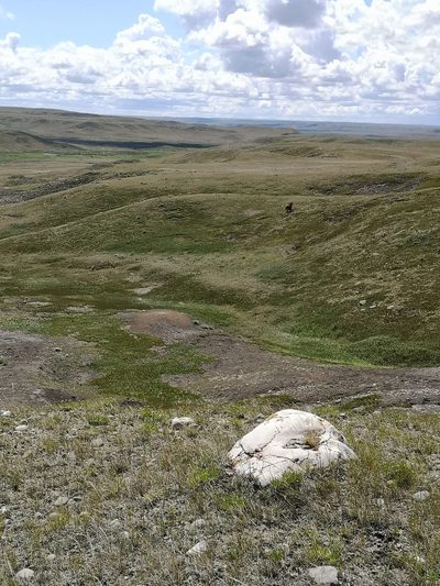
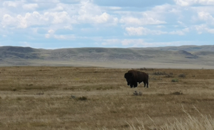
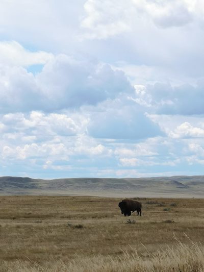
First, let’s start with a trail that highlights what “real” prairies are – unploughed grasslands. This hike is found in the West Block of Grasslands National Park, a park split into two sections about two hours’ drive apart, both along the American border. To immerse yourself in the rolling grasslands – an endangered ecosystem, in part because it makes such good farmland – and have a chance at spotting bison and burrowing owls, check out the West Block. Grasslands National Park has some trails loosely marked with flat plastic posts, but if you get lost (the posts sometimes get knocked down by bison) or deliberately step off trail to chase the horizon, the visitor guide has the GPS coordinates of the trailhead so you can find your way back.
I first hiked this trail in the summer of 2020. It’s easy to practice physical distancing when the land is so vast! Stepping out of my vehicle, I always read the interpretive panels and the information signs at the trailheads. The first thing that caught my eye at this one were the warnings – you should be coming prepared with enough water, and be on the lookout for rattlesnakes, bison, prairie dog holes, and “feeling small in a big landscape.”
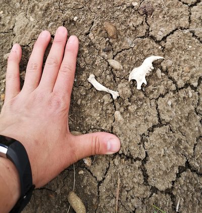
This is a landscape that is experienced either at the micro end or the macro end of the scale – I’m either crouched down looking at some small lichen clinging to a rock or the jaw of a prairie dog kicked up from a tunnel in one of their colonies, or taking in the immense view, where you can see for tens of kilometres around. The hills and coulees unfurl before you. For those who are used to hiking in a treed landscape, you may be surprised at the diversity of views before you.
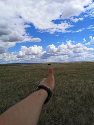
Bring binoculars, not only to watch for birds, but to also check if those distant dots are cattle or bison. As a professional bison aficionada, I was always thrilled when we encountered bison – giving them their space of course. How close is too close? Use your thumb: hold up your hand in a thumb’s up position at arm’s length. If you can completely cover the animal with your thumb, you’re usually a safe distance to be on foot.
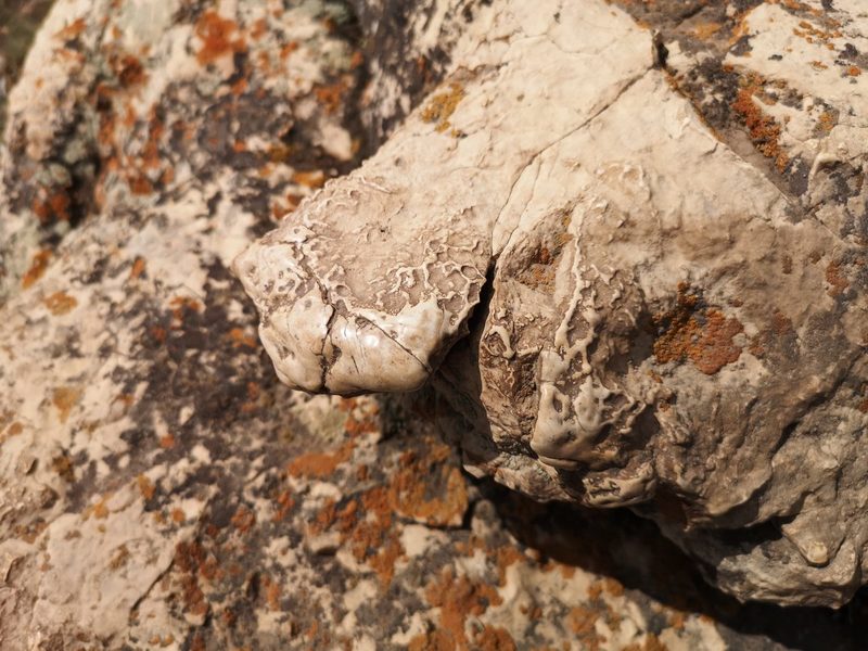
If you know what to look for, there are also little things that thrill. For me, that’s when I encountered numerous buffalo rubbing stones. They are erratics: large stones dropped by retreating glaciers millennia ago. They’re also perfect places for bison to scratch that itchy spot. One boulder I found, surrounded by hoof prints, had corners rubbed smooth and shiny. That wasn’t from the bison herd that had been reintroduced in 2005. That takes generations of bison rubbing that one spot. That was a historical rubbing stone, used by the herds of hundreds of thousands of individuals well into the 19th century, rediscovered by this small herd in the 21st.
This landscape has a depth of history, and a depth of view that is almost unparalleled.
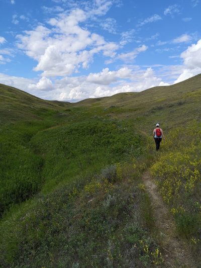
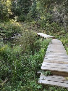
2) Boundary Bog Trail
Location: Prince Albert National Park, Saskatchewan
Distance: 2km
Type: Short hike
Difficulty: Easy
Website: Canada Parks Website
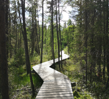
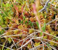
This trail is perfect for a short ramble. If you’re really cruising along, you can finish the trail in 30 or 40 minutes, but that means that you would miss so much! This is definitely the kind of trail where you want to stop and smell the metaphorical roses. The trail winds across rocky treed ridges and past knobs and kettles, and then across boardwalks that take you out over bogs and fens. There are thick beds of vibrant green moss, extensive patches of Labrador tea, and a whole bunch of small stunted tamarack (larch) trees. The first time I hiked this trail it was in the middle of winter and I was on snowshoes. The world had felt very black and white, the air as crisp as the snow. I emerged out among the tamaracks, and they were covered in such vibrant lichen that it was as if I’d stepped from the greyscale world of mid-winter into colour film.
In the fall, there are dozens of species of fungi to discover. In the spring, wildflowers can be found just off trail. However, my favourite part about this hike is that you can spot not one but three types of carnivorous plants, sometimes within one square metre of each other.
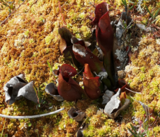
The easiest to find and the most alien-looking is the pitcher plant. They’re purple and green and veined, and their flowers look like strange sci-fi periscopes.
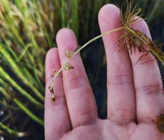
Plunge your hand into the water if you dare and lift up a string of bladderwort: an underwater plant with tiny pockets or bladders to catch macroinvertebrates. (Be sure to put it back after admiring!)
On some of the small mossy hummocks among the tamaracks you can find the sundew, which look like flat sticky cousins of the venus fly trap, only the size of my pinkie fingernail.
Before hiking this trail, I always thought you could only find carnivorous plants in the tropics, but here they are in the boreal forest of northern Saskatchewan! Remember how I said that if you’re in a rush you can finish this trail in thirty minutes? I’ve spent nearly 3 hours at a time on this trail, stopping to admire, examine, and photograph the natural world around me.
3) Grey Owl Trail
Location: Prince Albert National Park, Saskatchewan
Distance: 40km return
Type: One or two night overnight (recommended)
Difficulty: Difficult
Website: Canada Parks Website
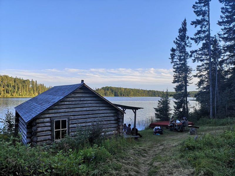
This is likely the most famous of the trails of Prince Albert National Park. This one is not only about the journey but also about the destination. It’s 20km to get to the two cabins on Ajawaan Lake, then 20km back. At Ajawaan are two cabins and three grave sites. Archibald Belaney, AKA Grey Owl, was a conservationist originally from Hastings, England, who took on a false “Indian” identity in the 1920s and 1930s. Anahareo, a Mohawk woman and a conservationist and author in her own right, married him, and they both lived alongside their pet beavers first in Riding Mountain National Park, then Prince Albert National Park. They are buried near the cabins with their daughter Shirley Dawn. When people make the hike to “Grey Owl’s Cabin”, they are making a pilgrimage to the grave sites of prominent if imperfect and therefore very human conservationists.
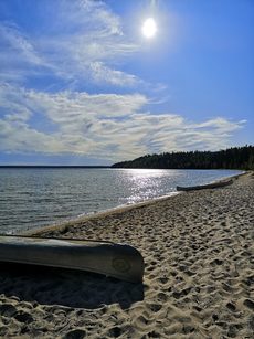
The trek itself is a challenge but achievable. You can do it by boat or by canoe along Kingsmere Lake. If you are going by water, plan to be delayed, though, as it’s notoriously choppy when windy, making further travel impossible. I’ve done it on foot, and the path may be full of roots but the views of the lakes are gorgeous. The path follows first the Kingsmere River, then parallel to Kingsmere Lake, for over a dozen kilometres, before you hike a short portage to get to the calm waters of Ajawaan. Being in such close proximity to bodies of water for the whole length of the hike, too, means that if you have a good water filter, you don’t have to carry in enough water to last you the whole time – you can pump or filter straight from the lake.
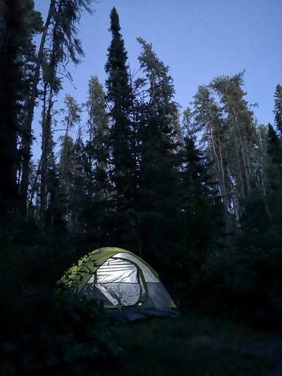
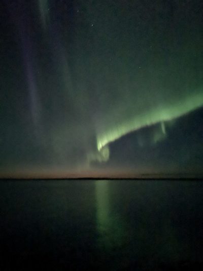
While some intrepid souls get to the trailhead really early, hike all day, and get back to their vehicles quite late (something only possible because of the long summer days), I prefer to do it as an overnight backcountry trip. If you’re just getting into backcountry camping, this is a perfect way to test out your gear and your mettle. The campsites are as “front country” as you can get in the back country, with fire pits, picnic tables, pit toilets, and piles of fire wood. The first night I ever camped out on the Grey Owl Trail, the aurora came out right after sunset. “Magical” doesn’t do it justice.
Join us this Fall, as our team will be taking a special hike in support of THE NATIONAL HIKE FOR THE ENVIRONMENT.
This nation-wide event will help re-connect people across the country with the natural world that sustains us, while raising support for the challenging work of Sierra Club Canada Foundation and our efforts to fight for urgent environmental protections.
Want to be a Hiking Hero?
1) Sign up on our CanadaHelps page as an individual or part of the Prairie Chapter Team.
2) Ask 10 friends to donate to your cause
3) Go for a hike! This can be on a mountain, on a favoured walking trail, indoors with your walking group, or even around your neighbourhood.
Lauren Markewicz, Executive Committee Member
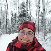
Lauren Markewicz is a public historian who has come to specialize in the history of bison. She is the author of Through the Storm: Canada's Bison Conservation Story, a book dealing with the twists and turns of the history of bison conservation in what is now Canada, in both images and text. She has worked at various historic sites and natural areas in Western Canada. She likes to spend time on the landscape, hiking and camping, and thinking a lot about the human relationships with and impacts on the land and the other creatures that live there.